After Temerloh, we suppose to go to the Kertau, Pahang where it's the location of bench-stone mark which indicate the center of Peninsular Malaysia. But, it's canceled because of weather condition factor.
Remote Sensing Malaysia Ground Receiving Station in Temerloh, Pahang became fully operational in 2003. The ground station enables satellite remote sensing data of the country to be acquired on real time basis. Currently, the station is capable of receiving data from the following six remote sensing satellites : Radarsat-1 of Canada; SPOT 2, 4 and 5 of France; USA Terra and Aqua satellites for MODIS data; Indian IPS-P4 satellite for OCM data and NOAA of USA.
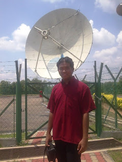
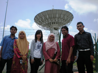
Hera are the antenna pictures :

1 : 13 m antenna for RazakSAT, Radarsat and SPOT data acquisition
2 : Antenna for acquisition of MODIS data from Terra and Aqua
satellites and OCM data from IRP-P4 satellite

They had brief us on oprational system and how the data acquisition be done. We were lucky because they willing to show us real-time image taken by
SPOT 5(satellite name). How the satellite start scanning from Taiwan to Indonesia. These section were in-charged by En. Azrin and Cik Rohana
Next, we went to antenna site.
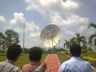
I didn't expected when the largest giant antenna suddenly moved and emit very loud sound which suprised some of my coursemate especially Yaman...haha...She just shocked...ish3x....it's was funny to see her behaviour... Yaman, it's just antenna, not transformer!...kui3x...


As a nutshell, I enjoyed this trip very much. It gave me new exciting experience and the vital things, my passion and motivation to persue my study totally increase... Yeah...G.I.S gonna lead this world!!
Live GIS..!!!