Monday, May 31, 2010

.: SELAMAT TINGGAL UTM :.

Kosong....Kosong.....Kosong...
Begitulah keadaan hostel time cuti nie..sume orang dah balik..foreigners pon dah blah..
tinggal kami jer yang menjalani Khemah Latihan GIS...Khemah Latihan pon dah habis...
So, masa untuk bercuti .....

Kemas2 bilik, sampu sampah, lap tingkap(tipu je), haha..buang apa2 yg tak perlu..
and semua lah....
Rasa sayang plak nak tinggalkan hostel nie....
Cuaca hari nie mendung selari dengan perasaan ku 'mendung' juga nak tinggalkan bilik ku...
Walau ap2 pon alasan, rumah la paling best!!
yeehaa...
rumah manis rumah....

sume orang teruja nak balik rumah...boleh dikatakan, jasad jer kat UTM..tapi jiwa kt rumah dah..

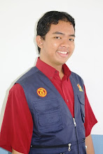
Nie la orang yang balik paling awal...siapakah gerangan insan misteri itu..??
Jangan biarkan hidup anda diselubungi misteri.....
Malam sebelum balik, Amir belanja ikan pari bakar....t.q Mir......


Nie la pemandangan bilikku yang x seberapa sebelum ditinggalkan buat sekelian lamanya..ooooo..Will gonna miss my wallpapers, my decoration, my bed...my study desk..
Oh, berposing atas motor Nub...gambar diambil oleh MujaMuja.....

Well, kutinggalkan UTM, Skudai, 2nd Year, 2nd Sem dgn perasaan berbaur..
Manis, masam,pahit,..sume ada
Kenangan itu akan ku semat utuh dalam sanubariku...
Experience is the best teacher!

.: HARI TERAKHIR GIS TRAINING CAMP :.

YIPPI...!!
Akhirnya, we came to the end of the day of Second Year Student... So, for the final task, kitorang kene wat presentation+poster berkaitan dengan GIS Camp nie...

Kene la pandai2 bagi kerja...It's a group work....ada yg wat report..ada siapkan poster.and wat lah apa2 yang tak siap lagi..sume berkerjasama dalam menjana idea yang paling bernas untuk ditonjolkan kpd lecturers nanti..

Kitorang diadili and dikritik oleh Head of Department, Prof Md Nor, Encik Hakim, Encik Ivin, Prof Safie and our coordinator, Encik Imzan.... seronik gak wat camne sebenarnya..Ye lah, when we present, there is someone to judge us..At least we know, what's our weakness and strongness...


Malam tu, kitorang duk kat Lab GIS almost kol 4 pagi baru balik bililk..sampai kawan aku sorang nie dah ting tong dah..haha....this is what we call as experience, right...hehe~

Masa tuk presentation start kol 8.30 pagi...Mengantuk ,letih,nervous(ada la sket), lapar(tak sempat nak makan)..sume ada..tapi tak pe...apabila mengenangkan hari nie dah last day..huh..BErtahan..!bertahan..!


Nie la poster group kami yang sempat disiapkan...Cantik tak..?haha.....o.k la tu with the resticted time allocated......


Untuk presentation, kitorang daj wat yang terbaik setakat yang termampu... Sorang lecturer bgtau, we did a great job.....Pas habis presentation, yeeha, rasa lepas sume beban yang tertanggung atas kepala nie...*sight of relief*..... berbaloi3x......Senyum sampai telinga.... ;)


Thanks my Group 3....Muhaimin, Afiq, Nadia, Bana, Shiau Xian....You're great..!(Bunyi latar orang tepuk tangan sambil berdiri)..hehe...

.: VISIT TO SATELLITE GROUND RECEIVING STATION, TEMERLOH, PAHANG :.

O.k, the next day,we had a visit to Temerloh Pahang. Actually, students are not allowed to enter this place due to security reason. But, with the help of our beloved head of department, we managed to got here..Thanks Prof!

After Temerloh, we suppose to go to the Kertau, Pahang where it's the location of bench-stone mark which indicate the center of Peninsular Malaysia. But, it's canceled because of weather condition factor.

Remote Sensing Malaysia Ground Receiving Station in Temerloh, Pahang became fully operational in 2003.
The ground station enables satellite remote sensing data of the country to be acquired on real time basis. Currently, the station is capable of receiving data from the following six remote sensing satellites : Radarsat-1 of Canada; SPOT 2, 4 and 5 of France; USA Terra and Aqua satellites for MODIS data; Indian IPS-P4 satellite for OCM data and NOAA of USA.

Hera are the antenna pictures :

1 : 13 m antenna for RazakSAT, Radarsat and SPOT data acquisition

2 : Antenna for acquisition of MODIS data from Terra and Aqua
satellites
and OCM data from IRP-P4 satellite

3 : Antenna for NOAA satellite data acquisition


They had brief us on oprational system and how the data acquisition be done. We were lucky because they willing to show us real-time image taken by
SPOT 5(satellite name). How the satellite start scanning from Taiwan to Indonesia. These section were in-charged by En. Azrin and Cik Rohana


Next, we went to antenna site.


I didn't expected when the largest giant antenna suddenly moved and emit very loud sound which suprised some of my coursemate especially Yaman...haha...She just shocked
...ish3x....it's was funny to see her behaviour... Yaman, it's just antenna, not transformer!...kui3x...


As a nutshell, I enjoyed this trip very much. It gave me new exciting experience and the vital things, my passion and motivation to persue my study totally increase... Yeah...G.I.S gonna lead this world!!
Live GIS..!!!